History

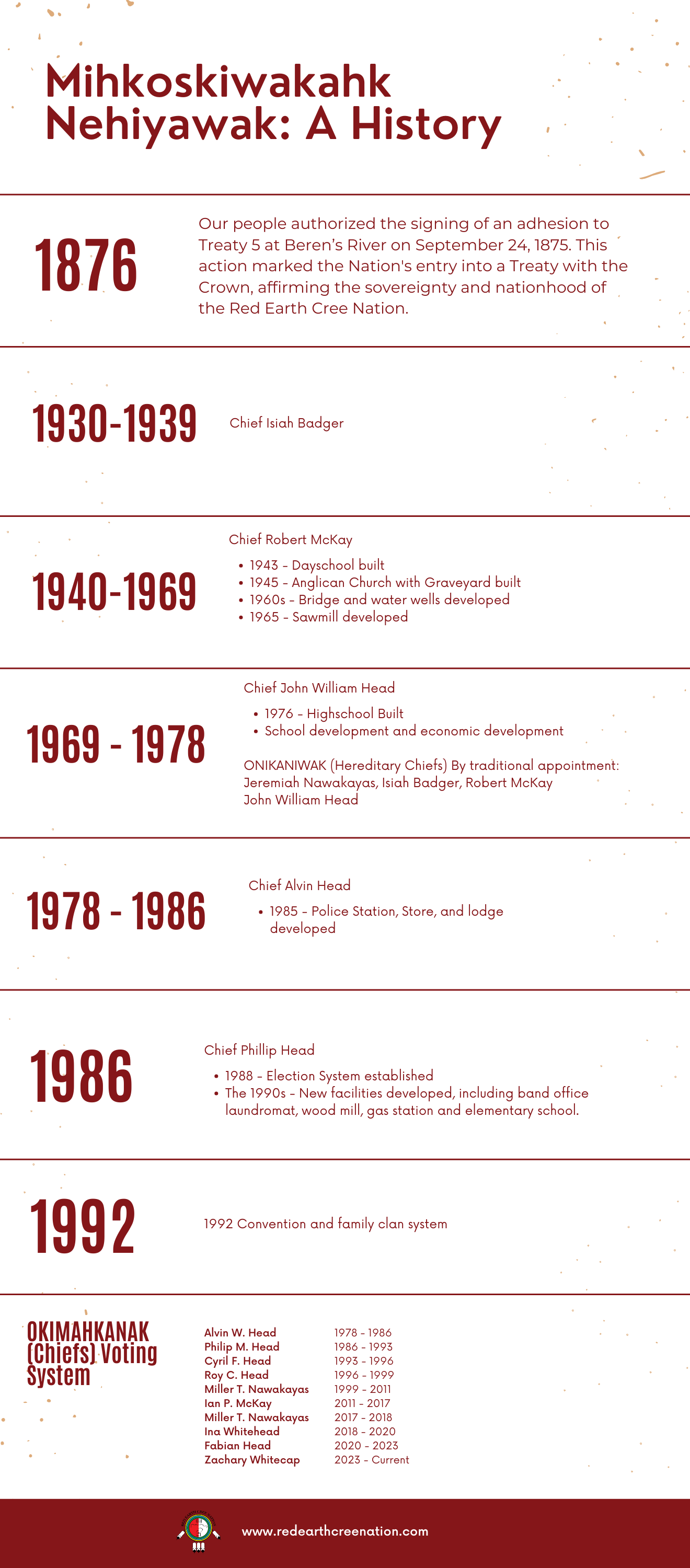
Treaty No. 5 was entered into by the Saulteaux and Swampy Cree on September 20, 1875. The Treaty covers the central region of Manitoba, extending south as far as the southern tip of Lake Winnipeg and north to a point on the Nelson River, northeast of Thompson and westward including a small area of land in mid-Saskatchewan and the region of northwestern Ontario.
Treaty 5, like Treaties 1 and 2, provided for reserves to be set apart for the signatories, to the extent of 160 acres for each family of five, or 32 acres per person. Unlike Treaties 1 and 2, however, Treaty 5 specifically made references to the setting apart of reserves for “farming lands” and “other reserves” for the benefit of the Indians. Prior to the signing of Treaty 5 in 1875, the Minister of the Interior, David Laird, advised the Lieutenant Governor of the Northeast Territories, Alexander Morris, that the primary object of concluding a treaty that year was to meet the wishes of certain bands with a view to the early selection of their reserves. If at all possible, consultation with the Indians on reserve selection was to take place immediately.
Red Earth or Mihkoskiwakak is situated along the Carrot River in northwestern Saskatchewan. The Red Earth Indian Reserve (IR) 29 and Carrot River Indian Reserve 29A are located approximately 77kms east of the Town of Nipawin. The Pas, Manitoba, lies approximately 140 kms east of Red Earth. In the 1800’s, the Shoal Lake Crees had marriage ties with The Pas Band, while Red Earth Crees associated with the Crees at Fort a la Corn.


